China launches third high resolution satellites at resolutions up to 1 m (photo) | high | satellites _ news
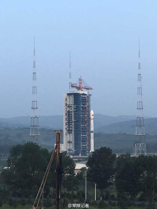
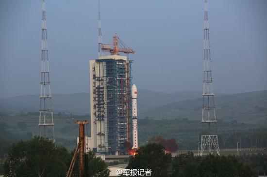
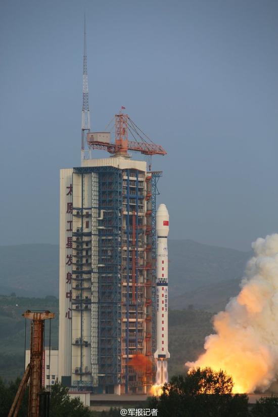


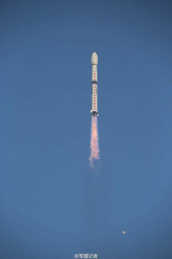
Xinhua News Agency, Taiyuan, August 10 (reporters Yu Xiaoquan and and Lu Jun and and Yang Weihan)-Beijing 10th 6:55, at the Taiyuan Satellite Launch Center in China with a long fourth-c launch vehicle successfully high third satellite is launched. This is the first resolution of up to 1 m c-band multi-polarization synthetic aperture radar (SAR) imaging satellite.
High points third, satellite is China National technology major special "high resolution on to observation system major special" of development engineering project one of, has high resolution, and big Imaging width, and more imaging mode, and long life run, features, can clock and full day achieved global marine and land information of monitored monitoring, and through around attitude mobile expanded on to observation range, and upgrade fast response capacity, will for SOA, and Ministry of Civil Affairs, and water, and China Meteorological Bureau, user sector provides quality and high precision of stable observation data And support maritime rights and maintenance, disaster risk warning, water resources assessment and management applications such as forecasting, severe weather and climate change effectively change the status quo of China's dependence on imported high-resolution SAR images, the marine power and "along the way" construction is of great significance.
Experts said that high third satellite with 12 kinds of imaging modes, covering traditional Strip imaging mode and scanning imaging mode, as well as marine-oriented imaging model and the global observation of the application of imaging modes, is the world's largest imaging mode synthetic aperture radar satellites. Satellite imaging site wide, combined with the advantage of high spatial resolution, can achieve large scale census also detailed specific areas, to meet the needs of different users on different targets. In addition, the third satellite is China's first design service life of 8 years of remote sensing satellites in low Earth orbit, and can provide long term stability data for user support services, greatly increase satellite system effectiveness.
It is understood that high scores special project since its inception in 2010, satellite data are widely used in disaster relief, environmental protection, land and resources survey and monitoring, fields, fostering the formation of a large industrial development, have achieved good social and economic benefits. In satellite applications, for example, as of July 2016, high scores of satellite data in 18 industries are widely used, more than 1800 units, nearly 6 million views of data used by the industry today.
High score long fourth and third satellite launch vehicles, respectively affiliated to China Aerospace Science and Technology Corporation, the Chinese Academy of space technology, the Shanghai Aerospace Technology Research Institute. The launch was No. 233 of the long March rocket series.
Responsible editor: Zheng Hanxing
Article keywords:-High satellites
I want feedback
Save a Web page
Xinhua
中国成功发射高分辨率三号卫星 分辨率达到1米(图)|高分|卫星_新闻资讯
新华社太原8月10日电(于晓泉、路俊、杨维汉)北京时间10日6时55分,中国在太原卫星发射中心用长征四号丙运载火箭成功将高分三号卫星发射升空。这是中国首颗分辨率达到1米的C频段多极化合成孔径雷达(SAR)成像卫星。
高分三号卫星是中国国家科技重大专项“高分辨率对地观测系统重大专项”的研制工程项目之一,具有高分辨率、大成像幅宽、多成像模式、长寿命运行等特点,能够全天候和全天时实现全球海洋和陆地信息的监视监测,并通过左右姿态机动扩大对地观测范围、提升快速响应能力,将为国家海洋局、民政部、水利部、中国气象局等用户部门提供高质量和高精度的稳定观测数据,有力支撑海洋权益维护、灾害风险预警预报、水资源评价与管理、灾害天气和气候变化预测预报等应用,有效改变中国高分辨率SAR图像依赖进口的现状,对海洋强国和“一带一路”建设具有重大意义。
有关专家表示,高分三号卫星具备12种成像模式,涵盖传统的条带成像模式和扫描成像模式,以及面向海洋应用的波成像模式和全球观测成像模式,是世界上成像模式最多的合成孔径雷达卫星。卫星成像幅宽大,与高空间分辨率优势相结合,既能实现大范围普查,也能详查特定区域,可满足不同用户对不同目标成像的需求。此外,高分三号卫星还是中国首颗设计使用寿命8年的低轨遥感卫星,能为用户提供长时间稳定的数据支撑服务,大幅提升了卫星系统效能。
据了解,高分专项工程自2010年启动实施以来,卫星数据广泛应用于抗洪救灾、环境保护、国土资源调查与监测等众多领域,培育形成了较大产业化发展空间,取得了良好的社会和经济效益。以卫星应用为例,截至2016年7月,高分卫星数据已在18个行业、1800多家单位得到广泛应用,各行业累计使用数据近600万景。
高分三号卫星和长征四号丙运载火箭,分别由中国航天科技集团公司所属中国空间技术研究院、上海航天技术研究院研制。这次发射是长征系列运载火箭的第233次飞行。
责任编辑:郑汉星
文章关键词: 高分 卫星
我要反馈
保存网页
新华网