Another artifact of China coming: from heaven to "see" | | | satellite monitoring the earthquake an earthquake _ news
For mastery of earthquake dynamics, our ancestors had invented the world's first seismograph by Zhang Heng. Today, the study of earthquake science and an "artifact" is born. Yesterday (January 17) convened Conference on China's earthquake Bureau said electromagnetic monitoring satellites built by China's independent research and development, "Zhang Heng, first" will be launched and put into use this year. By then, China will have full territory and global geophysical fields dynamic monitoring capacity, will also become the only in-orbit operation of multiple loads, high-precision seismic monitoring experiment satellite countries.
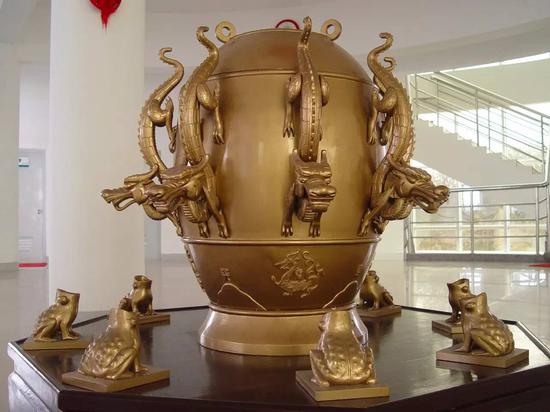
> Data chart: Zhang Heng's seismoscope (model)/vision China
What makes it difficult for earthquake prediction? Three big mountains to be crossed
On whether the earthquake forecasting, scientists have been controversial. Chinese Academy of Sciences, geophysicists said Chen yuntai, should hold cautious optimism of earthquake prediction. Many scientists believe that science is, after all, a solution, after generations of hard work, speed up the journey of scientific exploration, earthquake prediction possible at some time in the future.
Engineering Deputy General Designer Shen xuhui said electromagnetic monitoring satellites, placed in front of scientists has three mountains:
First, the case too little, enough to help scientists to form a complete scientific system and methodology. "Such as six-magnitude earthquake in China can only meet three or four times a year, seven earthquakes in China every three years in order to meet twice, which is not even enough statistical analysis of data. "Shen xuhui said.
Secondly, many constraints on earthquake research methods and tools. Earthquake in the ground, scientists are hard to go underground to see what's going on, and detecting site after all, scattered on the ground, it is difficult to understand global geophysical field.
In addition, the basic theory of earthquake research originated in the early days of Newtonian physics, physics development, basic theoretical study of mutual infiltration and seismological research there is an urgent need to absorb other relevant theory.
Change the angle of view to achieve some breakthrough out of the earth quake
How to cross the three big mountains? "But just about everywhere. "Shen xuhui," said earthquake crustal movement, the games cut magnetic lines, resulting in distortion of magnetic field lines, we can capture these signals via satellite, tracked earthquake precursors. ”
Launching a satellite, out of earth quake, will break a lot of earthquake research restrictions. "On the ground, seismic network in extremely cold area like the Tibetan plateau cannot be completely covered, the vast area of ocean we have been difficult to observe, but days later on satellite, it is not subject to the constraints of the natural environment, to the territory-wide in real time. Moreover, the force between the Earth and the Sun, for plate tectonics and seismic studies have helped, out of earth quake, can learn from the results of modern physics and space sciences for the development of earthquakes. "Shen xuhui said.
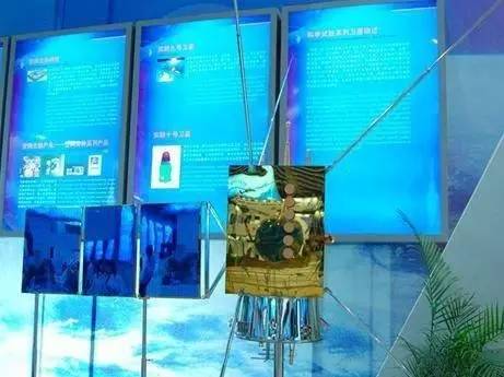
> Data: China earthquake monitoring satellite
Global data open new avenues
China Seismological Bureau said electromagnetic monitoring satellites to launch this year is the first day of the three-dimensional seismic observation system in China platform, ionospheric dynamics and its surrounding region, China it can be real-time monitoring and tracking of earthquake precursor, to make up for inadequate ground observation, further promoting the construction of three-dimensional seismic observation system in China, opening up explores new approach to earthquake monitoring and prediction. Meanwhile, satellites can provide aerospace, navigation, communication and other fields provide space for electromagnetic environmental monitoring services.
For global implementation of observation and statistical study of the global earthquake precursor characteristics for earthquake research, this is a very exciting thing. "So, I, while living, decade can get hundreds of seven-magnitude earthquake data, you can draw many lessons, satellites can provide scientists with valuable seismic earthquake cases. "Shen xuhui said.
First was tailored to advanced science and technology Zhang Heng expectations
Electromagnetic monitoring satellites family, first by Zhang Heng is not alone, joining Russia, and France and the United States, and Ukraine and other countries launching similar satellites are now retired, including France's DEMETER satellite on orbit 6.5 years in a row, was a huge success. "The seismic studies, expect one or two stars is not enough. "Shen xuhui said.
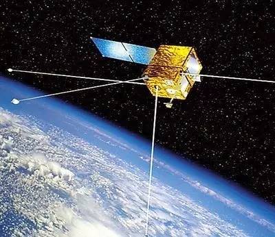
> Data map: France DEMETER satellite
Zhang hopes, first, its design specifications and load configuration more than similar foreign satellites. "In order to maintain life and similar satellites orbit in six hundred or seven hundred kilometers, but given the satellite you want to receive electromagnetic waves, and attenuation of electromagnetic wave propagation is, in order to receive the signal, we reduced to 500 km orbit. "Shen xuhui said.
At first view by Zhang Heng after the accumulation of large amounts of data and case, future prediction maybe really could become a reality.
> Editor: Zhang di
Article keywords:Seismic satellite monitoring
I want feedback
Save a Web page
China economic NET
中国又一神器即将出世:能从天上“看”地震|地震|卫星|监测_新闻资讯
为掌握地震动态,我们的祖先张衡曾经发明了世界上第一台地动仪。如今,研究地震科学的又一“神器”即将横空出世。昨日(1月17日)召开的中国地震局长会议上透露,首颗由中国自主研发建造的电磁监测试验卫星“张衡一号”将于今年发射并投入使用。届时中国将具备全疆域和全球三维地球物理场动态监测能力,也将成为唯一拥有在轨运行的多载荷、高精度地震监测试验卫星的国家。
>资料图:张衡地动仪(模型)/视觉中国
地震预报难在哪?三座大山待跨越
关于地震能否预报,科学家们一直存在争论。中科院院士、地球物理学家陈运泰曾经表示,对地震预报应该持有审慎的乐观。许多科学家相信,自然科学毕竟是有解的,经过几代人的艰苦努力,加快科学探索的征途,地震预报有可能在未来的某个时候实现。
电磁监测试验卫星工程副总设计师申旭辉表示,摆在科学家面前有三座大山:
首先,地震事例太少,不足以帮助科学家形成完整的科学体系和方法体系。“比如六级地震在中国每年只能遇到三四次,七级地震在中国每三年才能遇到两次,这样的数据连统计分析都不够。”申旭辉说。
其次,地震科学研究的方法和手段受到很多制约。地震发生在地下,科学家们很难去地下看怎么回事,而地面的探测站点毕竟分散,很难把全球的地球物理场搞清楚。
此外,地震研究的基本理论本身起源于早期的牛顿物理学,而如今物理学发展很快,基础理论学科相互交叉渗透,地震研究迫切需要吸收其他相关学科的理论。
换个视角求突破 跳出地球看地震
如何跨越这三座大山?“无非上天入地。”申旭辉说,“地震是地壳运动,这种运动会切割磁力线,造成磁力线的扭曲,我们可以通过卫星捕捉这些信号,跟踪地震前兆。”
发射一颗卫星,跳出地球看地震,将突破许多地震研究的限制。“在地面上,像青藏高原的极寒地区地震台网不能完全覆盖,面积广阔的海洋我们也观测不到,但是卫星上天后,就可以不受这些自然环境的约束,对全疆域实时观测。而且,地球和太阳之间的作用力,对于板块运动及地震研究都有帮助,跳出地球看地震,可以借鉴现代物理学和空间科学的成果促进地震科学的发展。”申旭辉说。
>资料图:中国地震监测试验卫星模型
纵观全球数据 开辟预测新途径
中国地震局透露,今年要发射的电磁监测试验卫星是中国立体地震观测体系第一个天基平台,它可以对中国及其周边区域开展电离层动态实时监测和地震前兆跟踪,弥补地面观测的不足,进一步推进中国立体地震观测体系建设,开辟探索地震监测预测新途径。同时,卫星还能为航空航天、导航通讯等领域提供空间电磁环境监测服务。
对全球实施观测,统计研究全球地震的前兆变化特征,这对于地震研究者来说是一件非常兴奋的事情。“这样一来,我在有生之年,十年就可以拿到上百个七级地震的数据,可以总结很多经验教训,卫星观测可以为科学家提供宝贵的地震震例。”申旭辉说。
先进科技量身定制 张衡一号被寄厚望
在电磁监测卫星家族里,张衡一号并不孤独,之前已经有俄罗斯、法国、美国、乌克兰等国家发射过同类卫星,目前均已退役,其中法国的DEMETER卫星连续在轨运行6年半,取得了巨大成功。“对于地震研究而言,指望一两颗星远远不够。”申旭辉说。
>资料图:法国DEMETER卫星
张衡一号被寄予厚望,其设计指标和载荷配置超过国外同类卫星。 “为了保持寿命,类似卫星的轨道高度一般在六七百公里,但是考虑到这颗卫星要接收地震电磁波,而电磁波传播过程是衰减的,为了更好地接收信号,我们把轨道降低到500公里。”申旭辉说。
在通过张衡一号观测积累大量的数据和震例之后,未来地震预测或许真的有望成为现实。
>责任编辑:张迪
文章关键词: 地震 卫星 监测
我要反馈
保存网页
中国经济网