China became the first country to obtain million meters of marine seismic profiles national
 The Chinese Academy of Sciences "research first" ship. Chinese Academy of Sciences
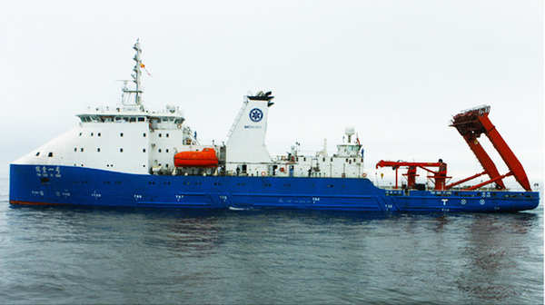
Xinhua Beijing on March 5, Institute of geology and Geophysics Institute for independent research and development of thousands of meters of ocean bottom seismographs, recently successful application in the depths of the Mariana Trench, Challenger deep in the world, China has become the world's first successful m-level sea artificial seismic country.
Recently, this reporter learned from the Chinese Academy of Sciences, "exploring the first" scientific expedition put three types all 60 ships in the waters of ocean bottom seismographs, 56, liangtiaowan was completed on February 28 meters deep seismic profiling, 10027 m and maximum depth of recovery respectively 10026, 669 km operational length of the section.
These data are extremely valuable. Experts, the ocean bottom seismograph is an important equipment for scientific exploration of the oceans of the Earth, by recording the seafloor seismic wave signals, the undersea formations are Seismic Imaging, provide the basis for understanding the seabed structure inside the Earth.
Institute of geology and Geophysics "95" period, after nearly 20 years of hard work, successfully developed million meters of ocean bottom seismographs. After Japan, China has also become the second independent research and development ability of meter-scale ocean bottom seismograph country.
On January 15 this year, the Chinese Academy of Sciences expedition aboard the deep "research first" scientific research ship set sail from Sanya, into the Mariana Trench, Executive Yap trench deep scientific investigation and equipment test tasks. At present, still in the Mariana Trench, Challenger deep sea expedition.
(Editors: Dou Yuan UN833)
2017-03-05 15:26:07
Surging news
中国成为首个获取万米海洋人工地震剖面的国家
中国科学院“探索一号”船。 中科院供图 新华网北京3月5日消息,中国科学院地质与地球物理研究所自主研发的万米级海底地震仪,近日在世界最深处马里亚纳海沟挑战者深渊成功应用,中国成为世界上首个成功获取万米级海洋人工地震剖面的国家。
记者日前从中科院获悉,“探索一号”科学考察船在上述海域投放三种类型共60台海底地震仪,回收56台,于2月28日完成了两条万米级人工地震剖面,最大回收深度分别为10027米和10026米,剖面实际作业长度669公里。
这些数据极为珍贵。专家介绍,海底地震仪是海洋地球科学探测的一种重要设备,通过记录海底地震波动信号,对海底地层进行地震波成像,为认识海底地球内部结构提供依据。
地质与地球物理研究所自“九五”期间开始,经过近20年努力,成功研发万米级海底地震仪。中国也成为继日本之后第二个具有自主研发万米级海底地震仪能力的国家。
今年1月15日,中科院深渊科考队搭乘“探索一号”科学考察船从三亚启航,开赴马里亚纳海沟、雅浦海沟执行深渊科学考察和装备试验任务。目前,科考队仍在马里亚纳海沟挑战者深渊海域。
(责任编辑:窦远行 UN833)
2017-03-05 15:26:07
澎湃新闻